Tuamotus: Watersports Heaven!

When it comes to sports, Rob and I prefer to be in or on the water. What better place than in the Tuamotus Archipelagos of French Polynesia. This interesting and diverse system comprises 75-80 "atolls" or low coral islands spanning 1500 km, between 185-500 miles northeast of Tahiti. The water is crystal clear and coral heads abut the sandy beaches and shallows as well as in the anchorages, requiring use of moorings or floats to keep anchors off the coral.
As is usual, Rob and I have been so busy meeting people, seeing new places and playing on the waters and beaches that I have not taken the time to document what we are doing. We have been in Tuamotus since 7/8/26, leaving Marquesas on 7/4/26. The sail was pleasant and entering our first pass was a bit scary, but turned out to be a non-issue since we have TWO engines that can push against current (another benefit of catamarans vs Monohulls). We since feel preety comfortable timing entries and dpartures based on time of day, tidal and current variations.
Forgive the seeming lack of temporal orgnization of these photos. The sequence that we have progressed thus far is Marquesas Islands to Tuamotus: Raroia, Tahanea, Fakarava, Tohau, Apataki, and Rangiroa, with next up Tikehau then Makatea before we head to the society islands of Tahiti, Moorea, and Bora Bora, Huahine, Raiatea, Tahaa, and Maupiti. We may not be able to get thru all these islands on this go round since we do not have a long-stay visa and have to leave September 22nd, but are planning to circle back around to either Hawaii or Panama again to wait out cyclone season and apply for our long-stay 6-12 month visa for 2027.
Our first Atoll in Tuamotus was Raroia which is gorgeous and we immediately met other cruisers in the anchorages and shared cruising plans and dinners together. We have run into some of the same cruisers that we met in Panama on our journey. The cruising community is very active on What's App to help with solving boat problems, trading recipes, sharing dive and wind-sport locations, etc. One particular App is called "No Foreign Land" and it is a great resource for finding info about almost anything you need from medical care to provisions, boat parts, restaurants, etc. People have asked for my medical consultations, which are pro bono of course.
I'll start with some of the gorgeous drone footage. The waters are 35-45 feet deep in most anchorages and crystal clear with views to the bottom most places.


These atolls were populated centuries before the Europeans came there. The indiginous Paumotu people were the original world navigators using celestial navigation, wind, clouds, bird flight, and currents to navigate great distances. This was documented in the movies "Kon Tiki", documentaries which depict the voyage of Norwegian explorer Thor Heyerdahl who traveled 101 days and approximately 4,300 miles across the Pacific from Callao, Peru, landing in Raroia, Tuamotus August 7, 1947. Rob and I visited that memorial, which we thought deserved much more fanfare than it was given here.


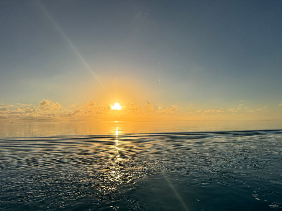
Flat calm tranquil waters often found in atolls make perfect conditions for diving or snorkeling.
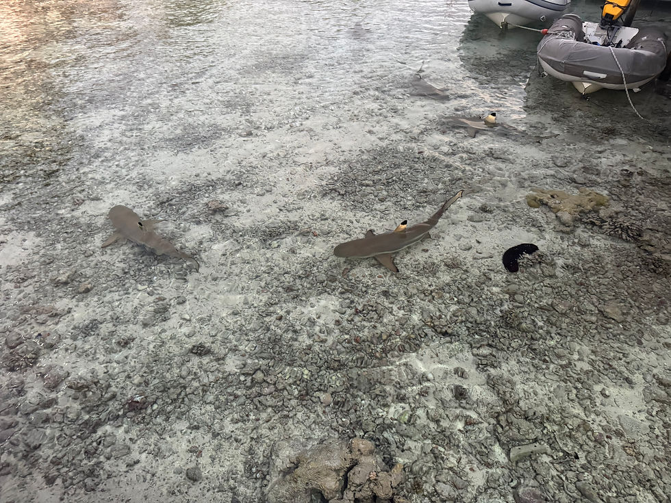

Rob and I wandered around the little village in South Fakarava and saw their little church, a cemetery with only a few graves, and what looked to be an open-air restaurant that we walked into to find it was someone's home! To top things off, the language in French Polynesia is closer to Tahitian dialect, but they do speak some French. It is quite amusing when I speak my 'Spanish-ized" French to them and ask for something to drink "boisson", and they think I am asking for fish "poisson".


Fakarava is part of UNESCO biosphere reserve so is a protected area. Hence all the fish!
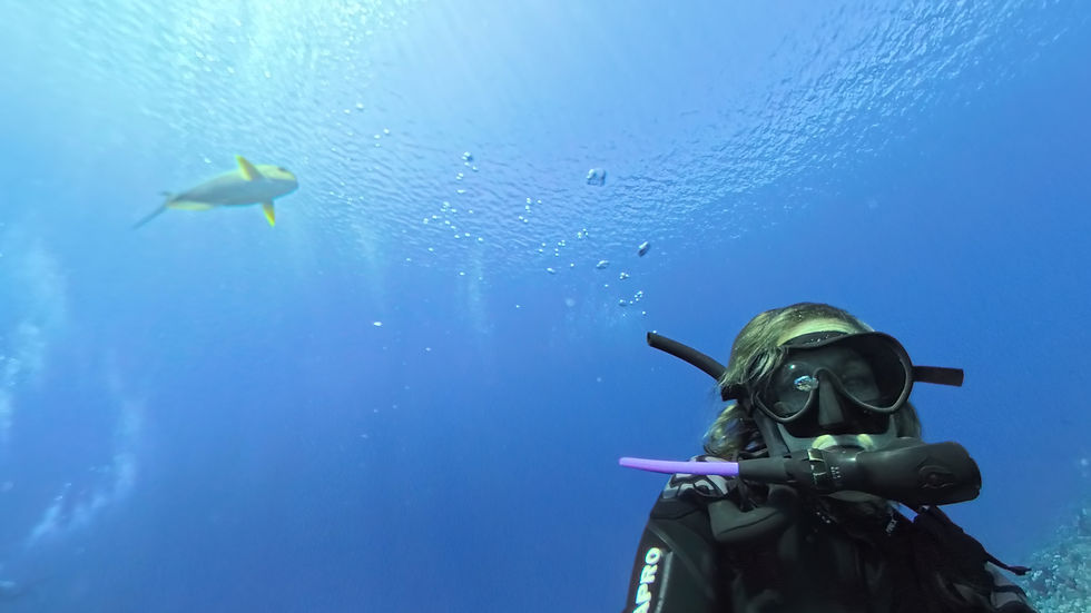
We did five dives out of South Fakarava pass with amazing fish including some larger pelagics, as well as plenty of sharks. Forgive my novice camera skills with a camera that is not really made for underwater photos, Insta360 camera.

Fakarava became a major diving destination after National Geographic featured a story about the diving in the South pass of the island. the two tiny resorts on this motu are quite primitive, but you are minutes away from a drift dive through an area that is teaming with fish and of course the famous "wall of sharks". Rob and I dived with our friends off their dinghy and had designated dinghy driver who picked us up inside the pass at the end of the dive. Rob and I did it on our own as well as diving outside on the wall where I jumped in with a pod of dolphins and also saw a wahoo, (and got no pictures!!!) as I was waiting for Rob to jump in. I am learning my Insta360 camera and still occasionally erase the photo I just shot! (Mantas, dogtooth tuna, wall of sharks...). I am also not a great photo editor, but I want to try to show just how amazing the coral development is and the abundance of fish.




In Fakarava South Pass area, above the water there were plenty of motus to explore with white or pink sand beaches and many shells and coconuts all over the place. We stayed here for almost a week diving the south pass five times and diving outside the pass once. We dived from our own dinghy or on our friends dinghy, avoiding the "cattleboats" that the other divers that visit this area are dependent on to get out on the reefs. Sad to say goodbye to this anchorage, but time to move up to two other anchorages: Hirifa and then the main town in Fakarava.

This town has two main stores or "magasins" the one at the gas station (the only one we've seen since Hiva Oa in Marquesas!) which was nicely stocked especially on Wednesday after the supply boats had come in. The dock was actually quite nice and large enough to pull a large catamaran up to for re-fueling. Gasoline is the same price everywhere in French Polynesia, fixed by the French government.

The main motu of Fakarava has a nice road that is paved for almost 12 miles and Rob and I loaded the bikes onto the dinghy and unloaded at the town dock. We biked past one organic raised garden , the town pizza place, a tattoo parlor, and a few other small businesses. It is a surprisingly busy little town with few cars, but plenty of bikes. The road runs down the atoll with deserted beaches and rugged terrain on the ocean side and the inner atoll side with more sand beaches and some homes and very small neighborhoods.


It was very important to time the entry and exits through the passes at the atolls. Many atolls do not even have a navigable pass, others do, and some have perhaps two passes. These passes can be extremely treacherous if it has been very windy, blowing water up into the atoll over the reef. The water has to exit on the outgoing tide, but larger volumes of water can delay the end of outgoing tides, and cause very strong currents going out of the pass. Thus, it is best to try and go or come in at slack tide and we use a "Guestimator" to try to adjust the published/expected tides to the actual tides to minimize currents.

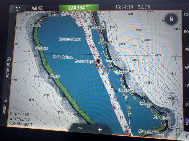
Rangiroa pass proved to be beautiful but strong with 5 knots of current against us. There are lots of resident dolphins that frequent the pass and play in the waves.


In addition, coming in after dark or before the sun is quite high enough can prevent optimal visualization of the many partly submerged coral heads known lovingly as "bommies". While we use a variety of navigation aids including Navionics , C-Map , and Open CPN, we also use Google Earth and Bing Earth to look at Satellite pictures of the areas. It also helps to have someone on the bow to look for navigational hazards. Sometimes this can be a little ineffective, as we found out in Apataki. I was on the bow looking out for submerged pearl farm buoys and lines which are 1-3 feet underwater. We were going slowly, but by the time I could see these buoys in that less than crystal clear water, it was all I could do to have Rob put engines in neutral to prevent fouling props as we crossed over several buoys in a short area on the way into the anchorage! . Fortunately, there was no damage to either the boat or the pearl buoys.
We always follow our tracks and share them with other cruisers to void any haards.

The Tuamotus has not disappointed as far as the places where we have had great wind and pretty calm areas to practice wing-foiling and kite-boarding. Most of the cruisers have given up the hassle of kiting in order to take up wing-foiling. The learning curve is steeper than with wind-surfing and kiting, but I have overcome the need to have a rescue boat and Rob has made it back to the boat on his own a few times, too.


We left Tahanea to go to Fakarava which was supposed to have better wind sport areas, especially Hirifa. Of course the wind was down when we arrived, so we enjoyed some paddle boarding, and walking on the beach before heading up to Fakarava town to get a few provisions and go bike riding. It was quite calm when we arrived and we ran into a couple of our buddy boats . We had met Vince and Inga on "Obelix" back in Tahanea and spent days winging together. Vince is an ironman athlete a few years younger than me and Rob, and gave me a great target to try to keep up with him wing-foiling.


While it was bittersweet to leave one atoll, we knew we had several more to get to before we made it to Tahiti and the Society Islands. Many atolls have only one way in, or pass , some have two, and some have none. The more passes, the better for having less standing waves and current running through. If there has been a lot of wind and waves for a few days prior, the atolls fill with water from the waves and do not have much if any incoming tide or slack tide. Sometimes the outgoing current counters the incoming waves creating several foot high standing waves with whirlpools and eddies.


In Tahanea we got a group of cruisers together for a lunch in town and had a water taxi pick us up and take us about 15 miles into the small town. There we found one small organic farm to get a few vegetables, a tiny magasin (store) owned by Gerard to get a few staple items, and then had a plentiful lunch of fish cakes, chicken, vegetables and rice.


We have at least a couple more atolls in Tuamotus on our must-see list. We just went in and out of Apataki in a quick overnight and sailed overnight to Rangiroa, second largest atoll in the world. There's a "big blow" for last two days with winds up to 30 knots and some rain; we have only had 4-5 days of rain since May! Today we dive the Rangiroa pass with the oldest dive operation in Tuamotus, Raie Manta Club, Rangiroa. Will be nice to have someone else handle the boat so we can go down over 100 feet where it is too deep to pull dinghy with us).
Stay tuned, as the Adventure continues! (Please also pray that Starlink rethinks raising its ocean cruising data rates since these will definitely affect the amount of communication that we have with loved ones . Thanks for enjoying our trip with us! Wish you were here!


Sheri and Rob,
Have been thinking so much about you guys and our fabulous meeting on The Sauvage in the South Pass. Fakarava is such a special place. Love following your blogs and living vicariously thru you guys on a life I wish I could live in the beautiful South Pacific! Please keep blogging - love it! Safe travels and abundant adventures! Denise Ditsworth, the Wyoming conspiracy theorist on Fakarava 🥰
Great photo journalism. You become a master aviator with the drone. My heart is full reading your bog. Tears of joy for you and Rob. So wish I was there!
Wow, took me some time to get through all the things you've both been up to. Love it! Wishing we were there with you too. Padele boarding, that takes me back to the time I tried and failed so many times! Keep on sailing and enjoying the paradise!